Itinerary, part A:
<Link to General
Information and Organizing the Trip
<Link to Detailed Itinerary
- Part B - Days 7 and after>
Links to riding days in this part:
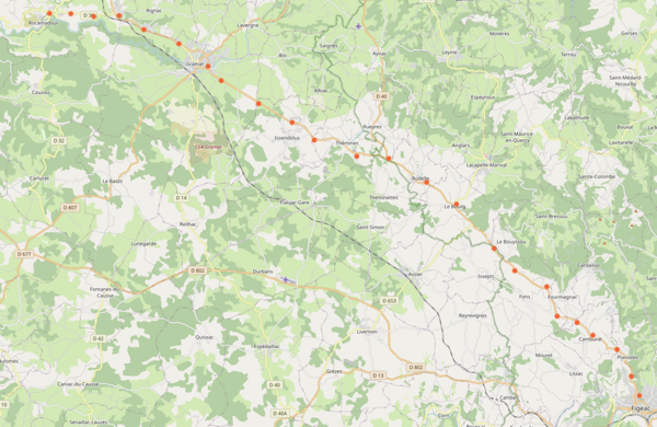
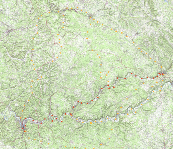
0,1,2,3,4,5,6,Rocamadour
Text in black is directions.
Text in italics is for alternative routes.
Text in brown is for comments.
Text in blue is for detours that are off the
Way of Saint James.
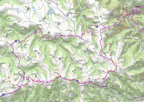
In March 2021 I added topographical maps from geoportail.fr and normal maps from openstreetmap.org; I also updated highway numbers, and clarified some of the directions.
For more detail than can be shown here, I suggest visiting the above map sites.
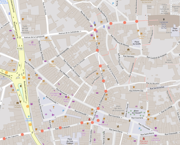
On maps,
red dots are the main bike route
orange dots are alternatives
The principle I used when designing this bike route was to stay as closeas practical, without experiencing extensive traffic,to the original pilgrims routes of a millenium ago. Those ancient routes are now often minor highways. The walking itinerary on the GR65 avoids highways; thus it often does not follow the ancient ways and is longer, but in using trails, tracks, and lanes, it more closely replicates the experience that the early pilgrims felt. The GR65 takes 31 to 39 days; hence by bicycle the trip from Le Puy-en-Velay to Roncevalle is
The Itinerary:
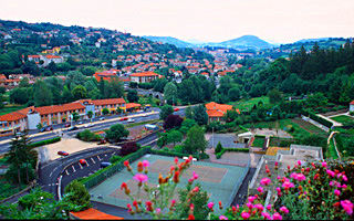
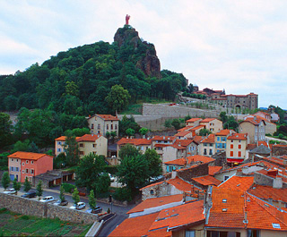
View of Le Puy fromSaint Michael chapel.
Day
0: Arrival in Le Puy: Arrive
at Le Puy-en-Velay***(elevation 625 meters), as per the discussion
of transportation in "How to Organize the Trip Yourself". Traffic in the new town can be moderate to heavy, but
you can walk your bike for the short distances on the sidewalks.
In the old city, traffic is usually light. If arriving in the afternoon
or evening, allow an extra day to visit the many interesting sites
in Le Puy, and to climb to its viewpoints. The Loire
Valley Bicycle Itineraryfrom the Atlantic Ocean, described at length on this site (Eurovelo 6 and continuation),
comes to an end at Le Puy, should you be planning an entire summer
of bicycling. You may stay in hotels, gites, or a campground, and
select from a wide variety of restaurants. Pilgrims may obtain their
passports at the welcome center behind the Cathedral between 5 and
7 PM.
Saint Michael d'Aiguilhe**, perched atop a volcanic extrusion
in Le Puy.
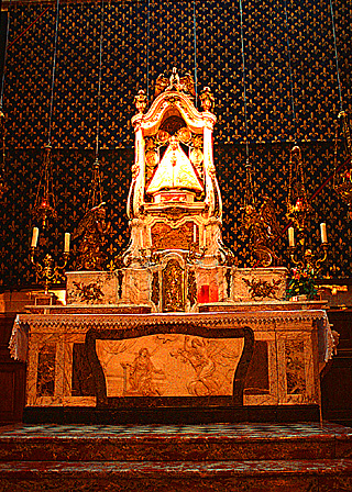
Leave your bike at your hotel or lodging,
and be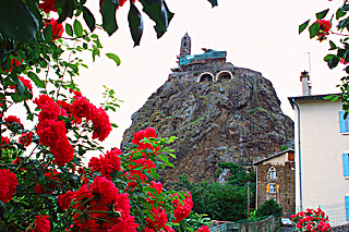 sure to visit the Cathedral*** and its treasury** displayed
in the Sacristy, and the Cathedral's cloister** and treasury** of
the cloister. Also be sure and visit the Chapel Saint Michel d'Aiguilhe**,
built on a volcanic needle in either the year 951 or 962 (and rebuilt
in the late 11th century). This is located in an attractive neighborhood,
which after walking up a hill requires climbing 267 steps;
the stained-glass windows are new but very attractive. The feeling
of the chapel is wonderful, and so is the view from its entry. If
you have time, you might climb up to the towering statue of Notre
Dame de France for an even better view*. sure to visit the Cathedral*** and its treasury** displayed
in the Sacristy, and the Cathedral's cloister** and treasury** of
the cloister. Also be sure and visit the Chapel Saint Michel d'Aiguilhe**,
built on a volcanic needle in either the year 951 or 962 (and rebuilt
in the late 11th century). This is located in an attractive neighborhood,
which after walking up a hill requires climbing 267 steps;
the stained-glass windows are new but very attractive. The feeling
of the chapel is wonderful, and so is the view from its entry. If
you have time, you might climb up to the towering statue of Notre
Dame de France for an even better view*.
The main entrance of the Cathedral of Le Puy en Velais.
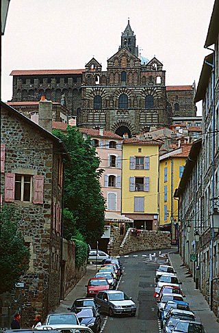
Explore the old town, and while you are
at it, you might reconnoiter the street by which you will be departing
the next morning. The gardens in the new town and the Museum Crozatier
(with its examples of old lace) are pleasant. Beware of the lace
sold in the town. Much of it is imported from China and is available
back home for a better price; but after some inquiries and practice
you will be able to spot some of the handmade pieces local to Le
Puy. If you are interested in this art form, you might wish to visit
the National Conservatory of Le Puy lace, located in the old town.
The Altar of the Cathedral of Le Puy.
Day
1 (44 km - 27 mi + 7 km optional): A daunting day to commence
your journey—with two climbs of 500 meters (1,650 feet)—and
more if you follow the author's recommended detour. But worth it.
If you are a pilgrim
or even if not, you may wish to attend the daily 7:00 am
Mass at the Cathedral, followed by the pilgrims' blessing.
You follow the Way within Le Puy:
The Way of Saint James
traditionally begins at the Cathedral, descends the steps, continues westward on Rue des Tables to the
fountain "of the choriste", then southward on Rue Raphael to the
square near the City Hall (Mairie). If you don't go to the Cathedral, begin your trip before City Hall. Now go westward on
Rue St. Jacques, which becomes Rue du Capucins.
You leave Le Puy-en-Velay (625 m, 2,050 ft):
Typical GR65 trail sign, seen near Le Puy.
I think you should follow the historical and modern walking route descrkbed below to leave the city—because you will quickly understand what it meant and means to be a walking pilgrim, and because you will have one last excellent view back over the city. If you do, you will climb very steeply, and surely have to walk your loaded bike. An alternate route out of Le Puy follows in italics.
Suggested route: From the intersection of boulevard St. Louis (the extension of bd. Fayolle) and rue Des Capucins, follow rue Des Capucins steeply uphill. After crossing under the rail line, and at the top of the hill, you will note the painted marks of the GR65—and other GRs, i.e., long distance routes—a white rectangle over a red rectangle. Turns are indicated by arrows, and an "X" means you are going the wrong way. The route is additionally marked here with the pictogram of a scallop shell.
View back over Le Puy from the pilgrims route out of the city.
Turn right and then left onto Rue de Compostelle, continuing to climb. When the road makes almost a U-turn next to a building, you have an excellent, final view of Le Puy. In approximately 250 meters, at the Y near a factory, where the GR continues left onto a stony road, you should branch right and coast down a hill back to the main highway, D589 (D means departmental—you are in the department, i.e., state, of Haute-Loire).
Alternative Route: The easier (less steep and less hilly), less interesting alternative route is to follow D589 out of Le Puy.From the square near city hall descend rue St. Jacques, and at the third intersection turn north on boulevard St-Louis, turning left at the Y, onto boulevard Gambetta (D590). After 400 meters bear left onto D589. Follow D589 uphill. You soon rejoin the main route.
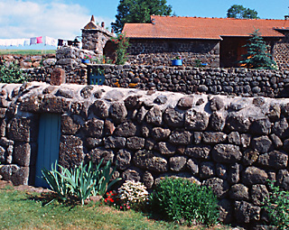
Wall and house near Augeac.
Continue climbing fairly steeply uphill on D589. Your total climb will be roughly 1,600 feet (500 meters) over 18 kilometers.
After crossing the major road D906, you have a choice of routes: To pass through quaint villages and by attractive stone houses (which you will see nowhere else along the route), turn left about 500 meters after D906 onto a minor road, and keep left to Augeac (where a GR65 variant comes in) and continue through les Bineyers. At Ramourouscle the GR65 joins, and follow the GR WNW and by the Capelle St. Roch to reach Montbonnet. Rejoin D589. (Chapels with the name Saint Roch abound along the Chemin de St. Jacques de Compostelle, because Saint Roch is the patron saint of pilgrims and other travelers).
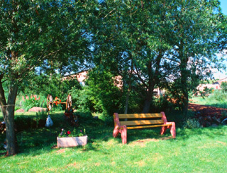
Bench for "pilgrims" near Binyers.
The alternativeroute is to stay on D589, straight to and through Montbonnet, a straighter, slightly shorter, and smoother, ride.
Soon after Montbonnet, the scenery changes from farmland to forest. Follow D589 west. The pass, 1.5 km after the town, has an elevation of 1,144 meters (about 3,600 feet). Be prepared: In the next 25 kilometers you are going to descend and climb back up some 1,600 feet. The descent begins: Your unchecked bicycle attains speeds of 50 kilometers (30 miles) or more per hour, but you have the smooth highway almost to yourself.
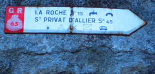
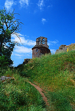
Halfway down, just after the picturesque village of St-Privat-d'Allier, you must decide whether to make a detour. I found this detour well worth the effort:: Ride for about 3.5 km on hilly roads, some used by the official walking route, out to the ruined tower and chapel of Rochegude. The chapel commands a spectacular viewpoint over the Allier river, 1000 feet below, and is touching in its simplicity.
Chapel of Rochegude.
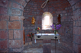
Interior of Rochegude chapel.
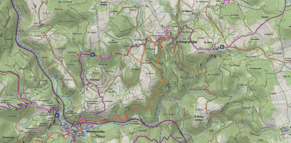
To ride to the Rochegude chapel, turn right off the main highway onto D301 just after St-Privat-d'Allier. This descends a short hill, climbs, and then slowly descends. Watch for the sign for the chapel on your right; the unnamed road climbs a small hill steeply to a village, turns left, and contours out to the chapel. Regardless of the type of bicycle you have, you must retrace your steps back to the main highway, as the GR descends too steeply for anyone but walkers.
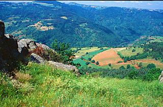
View over Allier River Valley from the Rochegude chape.l
Whether or not you made the excursion to Rochegude, from St-Privat dAllier you now continue downhill on D589 to the Allier river. Many bikers may choose to end their day here, in Monistrol-d'Allier, where there are hotels, gites, camping, other lodgings, a food store, and a train station. If so this may add a day to your trip, or you can ride a longer "Day 2".
You can either continue by staying on the highway, or by crossign through the town.If you ride into Monistro-d'Allier you can rejoin the main highway by riding north out of town along the river. At the Y, bear left and climb to the highway. The GR65 turn right as you leave the town, where there is a sign"seulement pour riverains" (only for residents) and comes back into D589, but the old road is too steep for a loaded road bike.
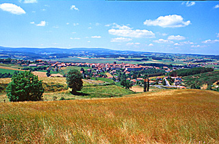
Overlooking Sauges.
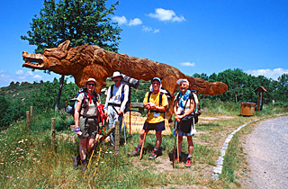
Walkers at the wolf monument over Sauges.
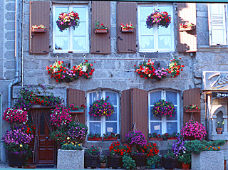
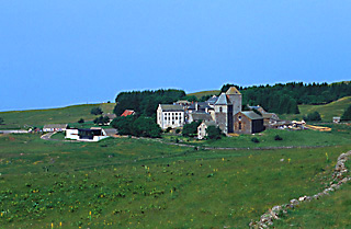
After a long climb, you reach a pass with a nice view to a higher distant mountain chain, and then descend briefly into Saugues (hotels, gites and camping) . Saugues is a charming old town, with an interesting and beautiful central square with a church, an "English Tower"and surrounding buildings, bedecked in flowers. Don't miss seeing them.
Flower bedecked facade in the main square of Sauges.
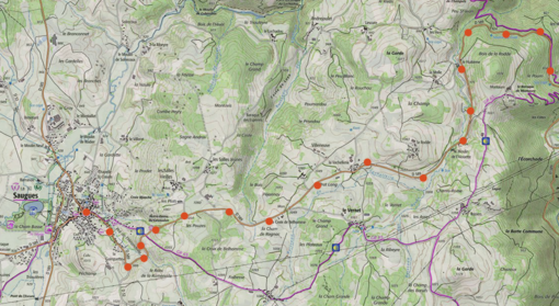
.Day 2 (44 km - 27 mi): This day is quite exhilarating, but has a dull start. After Day 1, your slow climb in elevation above Saugues (total gain of 340 meters in 23 kilometers, but with intermediate dips) should prove rather easy. (The GR65 follows tiny roads, trails and tracks that cut the diagonal of the bike route.)
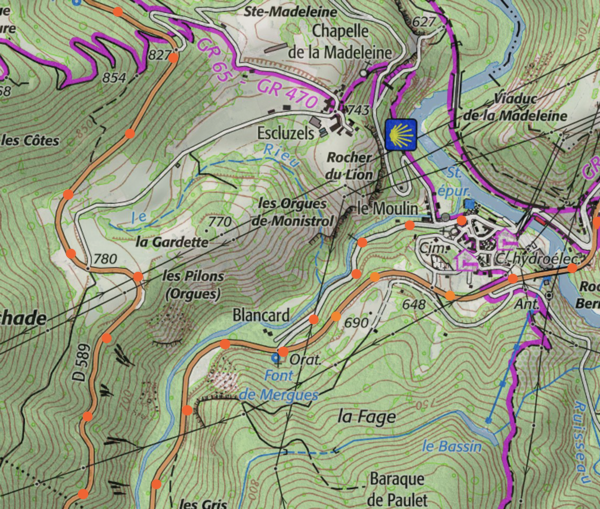
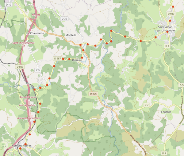
From the center of Saugues, pedal southwest on D589 to just beforethe river, and turn left to follow D585 south (slow, gently rolling climb) for about 6 kilometers. Just before Esplantas comes the first hill. Just after Esplantas turn right, southwestward onto D587, which climbs to a number of hill villages and drops back again, in pretty countryside of farms. You then begin to climb in earnest in the forest, with only a few brief descents, until you attain an elevation of 1,300 meters (4250 feet). A chapel to St. Roch stands here. The mountain chain, called the Margeride, is the one you saw in the distance yesterday. The pass area can be quite windy, and even dangerous in stormy weather. At this point the French department (i.e., state) changes from Haute-Loire (in the Auvergne Region) to Lozère (in the Langedoc-Rousillon Region), and the highway number changes to D987.
rees in the Margeride mountains with the plain in the distance.
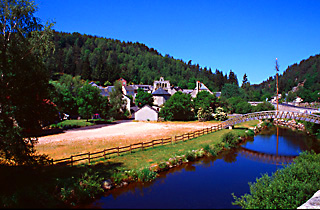
A long and glorious descent of 11 kilometers, practically traffic-free, ensues– into St-Alban-sur-Limagnole. If you wish to visit the town, dismount from your bicycle where the main road becomes one way against you and walk your bike; otherwise you would have to circumnavigate and climb back up to the town. You are 30 km from Saugues (hotels, gites and camping, many stores).
Terrain reminissant of New Mexico and Arizona,
near Remeize.
The village of Remeize.
From St-Alban you ride, still on D987, beside a stream in a charming canyon whose looks and smell reminded the author of northern New Mexico or Arizona. When D987 runs into D806, make a short jog to the left to pick up D987 again. A climb of approximately 8 km leads to the town of Aumont-Aubrac (hotels, gites, camping).
Day 3 (69 km - 41 mi): As during the previous days, you will face a long climb. Good weather is important, as you will spend much of the day crossing a high range land with few trees, as you might find in the Southwest USA above tree line. Cherish this scenery, as by the end of the day, after an incredible descent, you will be in a completely different, lower-lying countryside, the Lot Valley. Navigation is easy today, at least for the first 59 kilometers: Just keep going on the highway. I provide no map for the greater part of this day, since the route follows the highway.
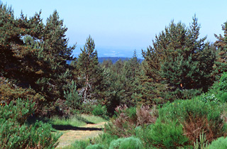
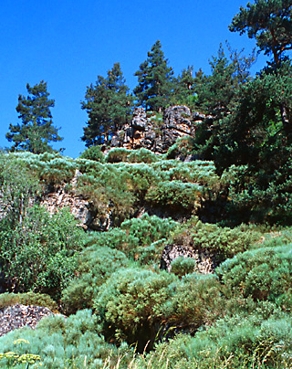
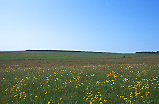
After climbing from the town on D987 and crossing the autoroute (expressway), you ride into micro-hilly terrain that resembles again the United States Southwest, for example the ponderosa pine park land near Santa Fe with some low-growing bushes that look like juniper but are not. You begin to climb, and 12 kilometers from Aumont-Aubrac you cross the Aubrac pass, and enter a high range land with grazing cattle. In this high land, at 1,100 to 1,300 meters ( 3,600 - 4,200 feet), called Aubrac, you continue riding for 15 kilometers. It is superlative in good weather, but don't be caught here when the weather is bad.
Praries of the Aubrac mountains.
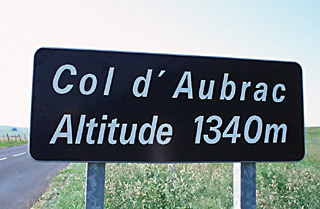
You traverse Nasbinals (km 22.5, gite and a few stores), located in a small valley, before you climb almost 300 meters (1,000 feet) to the pass (km 26.7), and enter the French department of Averyon in the Midi-Pyr'en'ees Region.
Highpoint of the trip,rgw Col d'Aubrac at 4,400 feet.
The tiny village of Aubrac, with its church.
Now starts your longest descent of the entire St. Jacques journey, 28 kilometers (17 miles). (You will have to turn your pedals a few times in the tiny but quite picturesque village called Aubrac (ruins of a monastery, gite, hotel, other accommodation), and there is another tiny hill after 13 kilometers.) After that, if you keep your wind resistance low, it is another 9.5 of pedal free riding until St-Côme-d'Olt (km 51).
It is possible that you might wish to take another route from the village of Aubrac to St. Come-d' Olt, passing through St. Chély-d'Aubrac. It involves a steeper initial descent, probably requiring brakes, and a climb of at least 150 meters (500 feet). Both the historical Way and the GR65 pass through St. Chély, but these routes can't be navigated by a road bicycle.. If you wish to follow this alternative, at the village of Aubrac turn left on D533, and follow that highway until St.-Chély-d'Aubrac. Here, be sure to cross the river and climb to Cambrassats. That road will eventually join D557 and arrive at St-Come-d'Olt.
St. Come d'Olt.
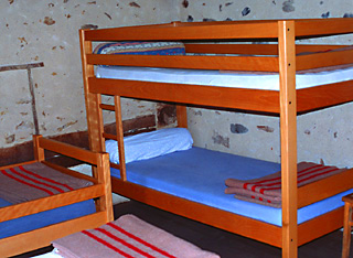
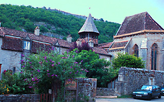
St-Côme-d'Olt (elevation of 385 meters - 1,260 feet) lies in the valley of the Lot River (Lot is a corruption in French of the original name "Olt"), and is a very charming old village with medieval half-timbered buildings. It could well be your stopping place for the night (hotels, gite, camping, about 60 kilometers from Aumont-Aubrac). At the minimum, it is worth an hour's visit . If you stay, you will want to take a very short, extra day on the following day to stay at Estaing. However, given the speed of the descent to Saint-Côme, you may feel, as did this writer, that it is too early to call it a day, and continue onwards.
Bunk room in the St. Come d'Olt gite
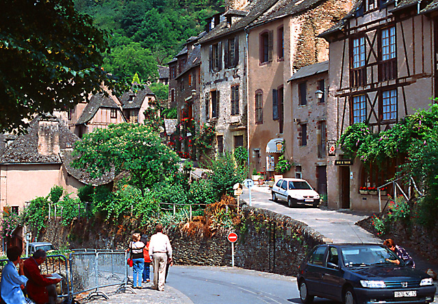
In six kilometers, slightly downhill along the Lot river you come into the large town of Espalion* —the largest town since Le Puy-en-Velay. (hotels, gites, camping, but to stay there you have to prefer being in or near a very large town). As you approach the town center, traffic builds up and becomes heavy. D987 ends here. You have a choice: You could continue straight ahead on D920 for Estaing on the main highway along the Lot River, a shorter and easier ride (traffic light to moderate). Or, ride through town, crossing the river in the direction of Bozouls. This itinerary follows the second choice.
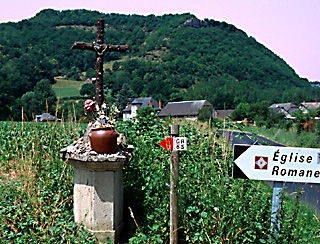
Signs and cross at the embranchment for the Bessuéjouls.
The 11-16 century Romanesque church of St. Pierre de Bessuéjouls.
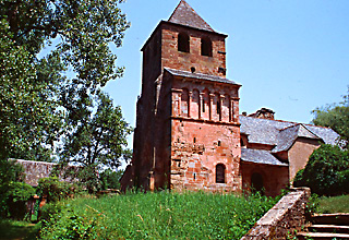
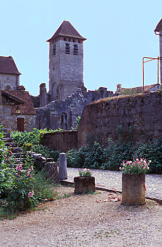
As you cross the river, stop and look left at the "pilgrims bridge". There are food and other shops just across the pilgrim bridge, on a charming narrow old street one block to the left of the highway. Continue uphill straight away from the water to the south, not taking the road which curves to your left. Before the end of the town you will see a sign for D556 on your right and Bessuéjouls. In about 3 kilometers a road goes off to your left near a cross and there is a sign "eglise romane" (i.e., Romanesque church). You crest a small hill and come upon the old church, St. Pierre-de-Bessuéjouls, which you can enter by pressing a button that unlocks the door.
Ninth century altar in the upper chapel of the Bessuéjouls
church.
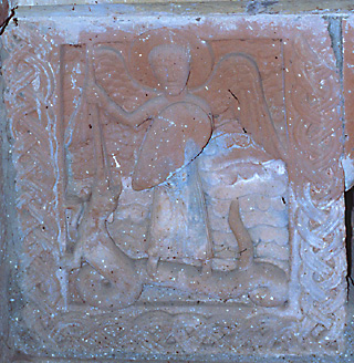
The church provokes a feeling of reverence. Climb the steep stairs at the back to arrive at the upper chapel in the bell tower, basically unchanged since the 11th century and with a ninth century altar. Grassy areas before and behind the church provide possible picnic spots. Retrace your path to D556. After 6 more rolling kilometers with one hill, you turn right and follow D100 for 2 kilometers to reach Estaing.
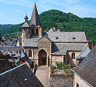
Approaching Estaing, with it castle out of a fairy tale.
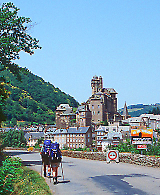
As you approach Estaing, the view of the town across the Lot is out of a fairy tale.Visit the churc, the chateau, and, the twisty old streets. Estaing has hotels, a gite, and camping (about 76 kilometers from Aumont-Aubrac, elevation 320 meters - 1,000 feet).
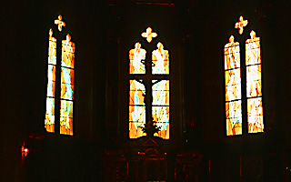
The church of Estaing.
Stained glass windows in the Estaing church.
One American luxury bike touring company offers a tour that spends a few days in the region. They spend at least one night in Laguiole*, where there is a luxury hotel with a panoramic view, and a Michelin*** restaurant. In the unlikely event that you are interested in pursuing this option, perhaps as part of a tour of the region, it is easily possible: from the village of Aubrac (not the town of Aumont-Aubrac) bike 20 kilometers northwest on highway D15 to Laguiole . The next day, or when you are ready to leave, follow the main highway (D921) and D22 to Estaing. Or stay on D921 to Espalion, ride up to St-Côme-d'Olt and back again, and then continue to Estaing.
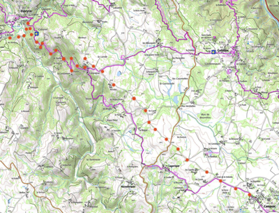
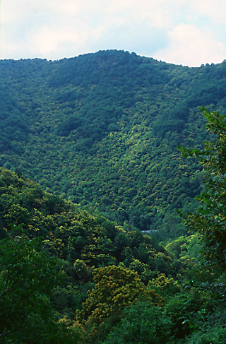
Day 4 (36 km - 21 mi): Today you will ride mainly through woods, undertaking climbs totaling about 500 meters or 1,600 feet, as did the ancient pilgrims. It is said that they were afraid of bandits lurking in the river gorges. Also, in those days, the rivers were higher and less tamed. (If climbs seem daunting, you can circumnavigate the hills by staying along the river, as detailed after the main itinerary. In fact you can do that tomorrow as well, but you'll miss out on some lovely scenery, and on strengthening those muscles for the ride ahead.) Your destination, Conques, is a highlight of this journey.
From Estaing, cross the bridge over the Lot river, and continue straight on D22, beginning a relentless, steep climb of about 180 meters, 600 feet over about 6 km. The road levels out, and you have a beautiful ridge-top ride until D22 comes to a T, 8 kilometers from Estaing. Turn right and follow D20 uphill, keeping right where D22 banches off left, again branching right at the Y, and turning left at the sign towards Campuac, reached in another 4 kilometers.
Embranchment near Campuac. Bikers should stay right on the main
road until the next left, which leads to the village.
(If you branch left towards Campuac before the sign, you will extra climbing, and the road is less good.) Note: The route you have followed to Campuac is actually the ancient pilgrim route, whereas the GR65 is not. (A road bike could not navigate this part of the GR5.) Should you wish to continue on the ancient route (which is not the same as that of GR65), do not turn left off D20 towards Campuac but continue straight another 5 km to near Golinhac, where it turns left; you continue on D42 to Espeyrac in another 8 or 9 km. This alternative routing is 5 km longer, and somewhat hillier than the author's recommended route.
(Disregard the details of the IGN 1:100,00 map for the following two paragraphs; it is inaccurate. The IGN 1:50,000 map is fine. On a Michelin 1:200,000 map the road appears to dead end.)
You can ride into the village of Campuac, or bypass it to the north: In either case you will want to get onto the route of "la Roque", D656. You will see a sign for it just before the village on your right. If you bypass the village, at the first oblique intersection, marked by a cross, bear right towards "la Roque". If you go into the village as suggested above, you will want to exit at an angle 45° to the right of the way you rode in, i.e., to the northwest, and then always continue straight. Now stay straight always (not turning left to the village of la Roque).
The forest above Espéryac. You must ride from the valley
to the summit of this range.
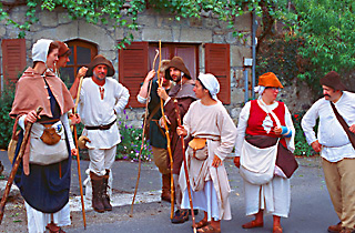
Pilgrims, some with bare feet, in medieval costumes.
The road is beautiful, flat or slightly descending ride through woods. You double back left and then right through the village of Campagnac, stay left at the next intersectionuntil the end of the road, where you bear left and descend a long hill into the river valley, almost coming back to the altitude of Estaing. AT the T, to visit the town of Espeyrac (hotels, gite, one food store), turn right and ride 300 meters.
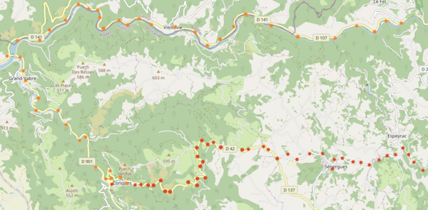
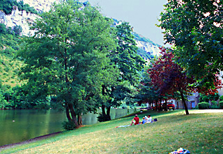
To continue, turn left onto D42. D42 climbs 265 meters (870 feet), passing through the town of Senergue (km 27.4,hotel, gite, shops), to a pass. Now, after several smaller descents and climbs through a countryside of open forest, you begin a long descent to Conques. If you have to find lodgings, or if you are not staying for the night, lock your bike at the lower end of the parking area. Once you have your accommodations (or if you are leaving town), walk your bike downhill into the village.
An alternative route to Conques follows river valleys from Estaing—deviating completely from the ancient pilgrim's route and avoiding that route's 600 meters (2000 feet) of climbing. It is faster and easier, but out of the spirit of this journey, and less interesting.
To follow the alternative route, from Estaing, stay on the main road along the Lot river, D920, for 17 kilometers to Entraygues-sur-Truyère (hotels)*. Follow the Lot gorge** westward on D107 and then D141 to the intersection of D901, about 18 kilometers. Turn south and ride 5 kilometers south along the Dourdou River. to the roadsign for Conques***, which is a short, 60 meter (200 foot) climb up into the hills.
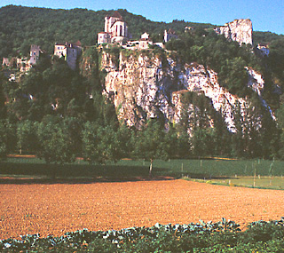
The upper village of Conques.
To visit Conques*** to see it or find lodgnings, padlock your bicycle at the foot of the parking lot near the entrance to the town. Conques has hotels, a gite in the Abbey, camping, chambre d'hôtes, rooms—but many visitors, and since you will want to stay in the main village, reservations are highly advisable (failing that, arrive early).This is an excellent place for a rest day).
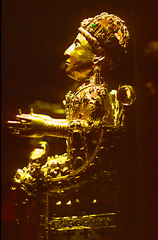
The most famous reliquary in the Conques monestary, the Gold
Majesty of Saint Foy.
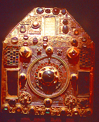
An ancient reliquary in the treasury of the monestary of Saint
Foy in Conques.
The front of the Conques church.
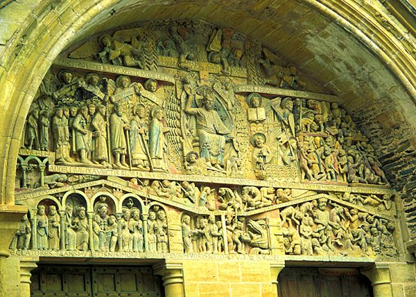
Conques*** is one of the highlights of this trip, clearly worth several hours or more of your time. The carving (of the Last Judgment) above the doorway to the Church of Saint Foy (1031-1140) is incredible, as are some of the relics in the church's treasury, the most famous of which is the Majesté d'Or statue. The town is lovely. In the evening, the church organ plays concert music as the sun sets, refracted in the recent, controversial, modernistic, duotone stained-glass windows of the church. In the summer, at 10:00 PM, a tour is given of the "tribunes" (the upper floor of the church, normally inaccessible), with many compelling stone carvings of both people and grotesque animals. For more information, consult the site http://www.conques.com.
Day 5 (43 km - 26 mi): This day brings with a strenuous climb, followed by beautiful ridge ride and an exhilarating descent. You then have a choice between a hill route and a river route to the charming city of Figeac. If you are a strong rider, and do not wish to spend the night in Figeac, you can continue on towards Cahors, spending the night in a small town.
From Conques, walk your bike downhill until the road becomes two-way (at the "star" on the road). Now ride directly down the hill, bearing left at the Y. Cross the main highway, taking the tiny roadway between two buildings. Cross the narrow, medieval bridge (mistakenly labeled a Roman bridge (should be Roman in French, rather than Romaine) onto "highway" D232. A very steep climb (10 - 15% grades) of 370 meters (1200 feet) ensues. Stay left at km 3, and again at km 5 when D606 comes in. At km 5.4 let two small ways go by on the left. Bear right onto D580 at about km 6.4, (or you may chose to ride slightly downhill to the left for 0.5 kilometer to visit Noaihac (gite, rooms), before returning by the same road to D580). In one kilometer, on the right is a beautiful chapel and a picnic area.
Pilgrims, or perhaps just long-distance hikers, on the ridge
near Nohilac.
My bicycle, in an almost arial view to the south from
the ridge past Nohilac.
Now ride, on the level, on a ridge top with stunning long-views, among beautiful pastures. (Note: The original pilgrim's route bears off to the right on D183, but the bridge over the Lot River is no longer standing, and the views on D580 are superior.) A descent begins. At an intersection just after the village of Agnac, D580 turns sharply left, while D218 goes off to the right.
Do not follow D580 unless you wish to take a longer route to visit a large, not especially attractive, mining town with all services and with traffic (and a train station 5 kilometers away). Rather, continue straight in the direction you were riding before on the chemin des Crêtes, at first flat, and then up a slight hill, on a somewhat rough road. After 500 meters you begin descending, and in another 600 meters there is a Y. Go left and stay left at the next street, and continue straight. The small street street you are on curves to the left, and then, when it curves back upon itself very sharply to the left, you must make a sharp right turn and continue downhill until you come to a stop sign. Turn right on the main road (heading north), and ride 50 meters over the crest of the hill to a major intersection. Bear left here onto D21 (Sign: D21 Livinhac-le-Haut). Ride steeply downhill, and cross the Lot bridge into Livinhac-le-Haut (km 21,hotel, camping, gite)
.It is possible, but not recommended, to bypass the authentic, arduous and beautiful section of the Route of Saint Jacques described in the previous two paragraphs—in about the same distance, but with much less time and effort. From Conques, simply ride north along the Dourdou on D901, then follow the Lot River on D42. Don't cross the Lot at Port dÁgres; rather jog right and continue on D627 into Livinhac-le-Haut.
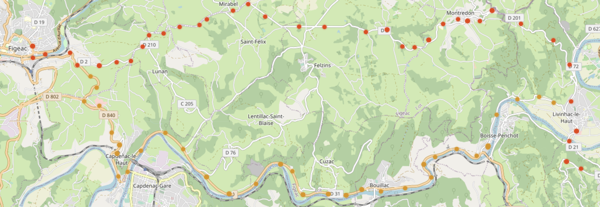
From Livinhac-le-Haut you have a choice of routes to Figeac. I have ridden both. One follows the historic pilgrimage route, which involves a climb followed by rolling hills, but I didn't find the scenery striking or enjoy the village of Montredon. To follow the historic route, simply stay on D21 to Montredon (150 meter-500 foot gradual climb), now in the French department of Lot, staying left at the Y (6 k from Livinhac-le-Haut) where highway D21 becomes D2), and follow rolling D2 until the intersection of N140 (moderate traffic), which descends into Figeac* (several one-star sites, charm many hotels including a deluxe hotel, camping, but no gite, train service). (The total distance from Conques to Figeac by this route is approximately 45 kilometers).
The other route to Figeac, which the author rode a few years ago, is faster, easier and more scenic, but has more traffic, and does not follow the ancient pilgrim's route. At Livinhac-le-Haut, after the town, turn left onto D632 and follow it along the north bank of the Lot, until it intersects with D840. Then follow D840 along the Lot to Capenac, and over a big hill into Figeac*.
Extra Day (43 km): Possible side-trip: As
did many ancient travelers, you may wish to deviate from the Route
of Saint Jacques to visit the incredible religious and tourist site
of Rocamadour***.
Rocamadour*** is a pilgrimage destination famous for its setting, its religious art, and its view. It is
highlighted in the Dordogne Itinerary on this Site. The Dordogne valley is only a short ride from Rocamadour. The present builings, dating from the seventeenth century, replace those destroyed by fire.
To reach Rocamadour
from Figeac, you will probably want to ride on the easiest route, D840. The author
has once done so, and on that occasion the traffic was not bothersome.
Turn off at D36 for L'Hospitalet, which adjoins Rocamadour*** (hotels,
gites, many campgrounds).
It would be possible to ride via back roads. In this case you should map your course on a good map, and expect to take 50% more time.
After your visite at Rocamadour, the next day, rather than retracing your steps to Figeac to return to the Road
of Saint Jacques, or following a national highway, you might well
wish to follow this routing: Rocamadour, D32 south 17 hilly kilometers
to D807, to Labastide-Murat (hotel; 8 kilometers), Then follow D32 and D565 south to Vers on the Célé. To go directly to Cahors, take D673 west to D23 to 820 south (total 61 kilometers). If so you will miss sites along the Célé.
Alternatively, one could return to Gramat and then ride south on D14 until it endsatr Espedallac, following D40 south ,turning left and tiding east about 1.5 km on D40b, again turning NE of D653 for 500 meters and turning right onto D13, which joins the Célé at St-Sullpice, about 37 km to the Célé, 70 km to Cahors.
Day
6: (85 km - 50 mi): This will be your first non-mountainous day. You won't be in mountains again until
your final day in the Pyrenees. But there will be
plenty of high hills ahead to keep you in shape.
I recommend that you follow the Célé River rather than the Lot
River. It is believed to be a historical route,
and you will be in a flat river bottom with pastures and farmlands within a wide, limestone-walled
valley, always on
the "descent", at the rate of less than one meter per
kilometer! The road surfaces in the Célé valley are quite rough, however, so you won't
be able to make especially good time until near Cahors.
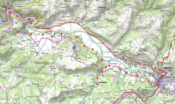
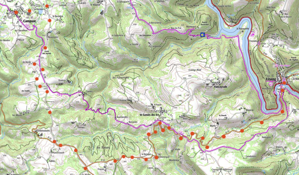
The Céle, Lot ,Carjac and Rocamadour historical routes
Another route followed by the early pilgrims and by the GR65 goes through Carjac, and then over the hills to Cahors. This route was higher and shadier, and maybe safer, which was and is important if you were/are walking, but dull and requiring extra effort for cyclists. To follow the alternative route, from Figeac take D19 to Gréalou (hotel) to Carjac (hotels, gite, camping), to St. Jean-de-Laur, to Limogne-en-Quercy (gite, camping), to Vaire (gite) and to Bach; then D22 to Laburgade and Cahors**, about 75- 80 kilometers over rolling land.
To follow the recommended route, from Figeac, take D813, the main highway towards
Cahors for about 4.5 kilometers (light to moderate traffic). Turn left
after a bridge onto D41 (now light to very light traffic). Or,
if traffic is heavy on D813, cross the bridge over the Céle
River that is a few blocks west of the town center, and follow D662,
bearing right onto D19 in 3 kilometers. If you do this, be sure
not to miss the right turn onto a small road in another 2.5 kilometers
or so, towards the Moulin de Béduer. If you round a sharp
curve to the left, you gone too far, and you will make an unnecessary
sharp climb into Béduer village.
Espagnac in the valley of the Célé River.
The very popular small gite of Espagnac is in this building.

Excluding the various side trips (described in subsequent paragraphs)
that you should plan to take, you will follow D41 for 55 kilometers
until the intersection of the Célé River with the
Lot River (camping, gites and hotels all along Célé valley, especially at Marcilhac and Cabaret; very light traffic).
The Célé River passes by a park in Marciallac.
The Marciallac Abbey.
Recommended short visits along the way in the Célé
River valley are: Espagnac-St-Eulalie—church, and priory ruins;
and Marcilhac—pleasing park along the water and ruins of ancient
abbey. Nearby is the cave of Belvue*, but you should save you energy
to visit the very special cave described in the next paragraph.
A steep climb from j Cabrerets of about
150 meters (500 feet) in 3 kilometers is the cave called the Grotte
du Pech Merle**, well worth your visit, as it contains well-preserved, 25,000 year-old cave paintings of prehistoric animals. https://en.pechmerle.comAllow
about 2.5 hours for climb, the visit, and the descent.
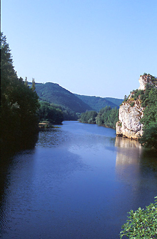
The Lot River, about 20 kilometers before Cahors
At the Lot River, follow D10 for 28 kilometers into Cahors (light plus traffic, except moderate traffic before Cahors). You can enter Cahors either by riding right up the hill following the signs for the city center, or by staying along the river, and curving right to the Louis Philippe bridge. (For a less busy but hillier route to Cahors , cross the river just after Vers on D49, then turn left and follow D911 to the Cahors bridge—about 13 kilometers. Cross the Lot into the city.)
St. Cirque Lapopie, an ancient fortified village, now an artist
colony, perched atop a cliff, above the Lot River.
Another detour taking 10 km round-trip begins at the confluence
of the Lot and Célé rivers, 4 kilometers south of Cabrerets,
and leads to St-Cirq-Lapopie**, a fortified, very-well
preserved, picturesque, middle-ages village on a cliff 100 meters above the river. It commands
a wonderful view of the region with well-preserved architecture of the Middle Ages and a 15th century church. (artist colony, hotels, rooms, gites, and nearby camp sites). Going there,
take D662 on north side of the river (2 tunnels - light traffic) to the bridge and them climb;
to return, stay on D40 on the south side of the river until
Bouzies.
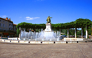
Statue in the main square of Cahors.
Cahors** is a large town, with all services (many hotels, gite, moderate to heavy traffic, train service).
The principal sight is the Valentré bridge**—a great,
example of middle-ages military construction, with towers and parapets.
It is located on the west side of town. You may also wish to visit
the Cathedral St-Étienne*, with its splendid northern doorway
and its cloisters.
<Link to Detailed Itinerary
Part B - Day 7 and thereafter>
<Link to Part I:
General Information and Organization for the Saint Jacques de Compostelle
Trip>
<Link to Detailed Intinerary - Parts A and B - without photos and in smaller type for printing>
To List of Great
European Bike Tours
Home Page
|